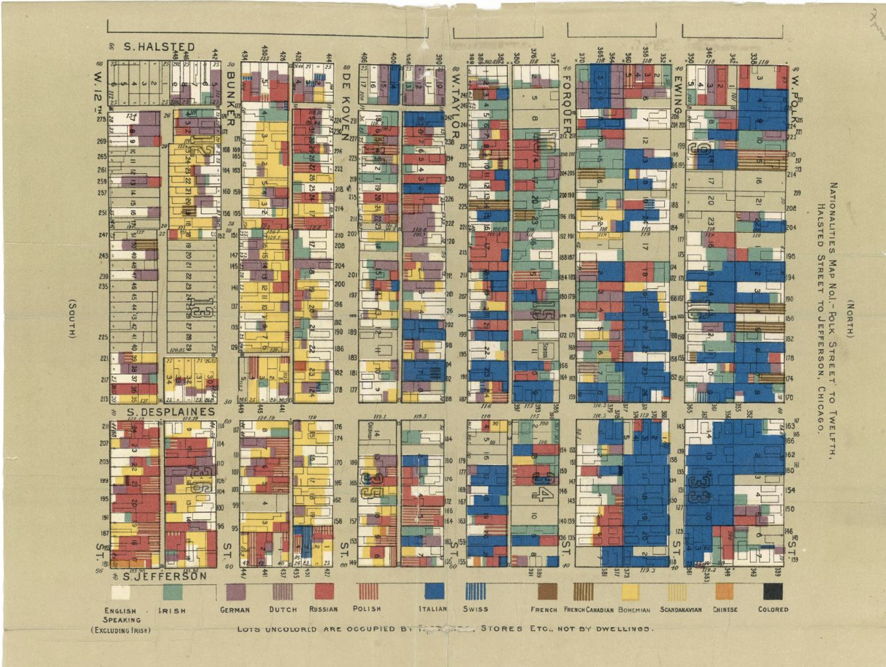
Image: A map of the South Side of Chicago, with differently-shaded areas to indicate population demographics. The caption reads, “Nationalities Map No. 1 – Polk Street to Twelfth, Halsted Street to Jefferson, Chicago,” The archive entry reads: Hull House Map (Nationalities), 1895. b: Hull House Map (Wages), 1895. Image sourced from Hull House Maps & Papers.